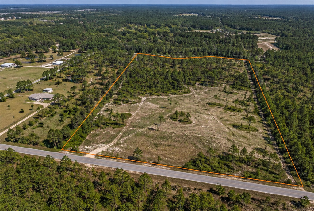
Aerial view of wooded acreage and surrounding roads in Northwest Florida

Land + Aerial Media · Northwest Florida

Give buyers the lay of the land.

Vacant land, acreage, residential lots and development parcels. Show the setting from above and the access from the ground, with coverage built around the property.

Land PhotographyAerial StillsAerial Video
Land + Aerial
Ground + Drone Perspectives
Acreage-Based
Land Package Coverage
FAA Part 107
Professional Aerial Operations
Northwest Florida
Crestview Based

Choose Your Media

Start with the property.

Choose aerial-only photography, complete aerial + ground coverage, or cinematic aerial video based on the property and the marketing needed.

Aerial-Only Photography

Aerial Photography – Land

Professional aerial photography for vacant land, acreage, development sites, and larger parcels. Coverage focuses on the property, road frontage, access points, surrounding context, and key visible land features from carefully selected aerial perspectives.

  • Aerial property perspectives
  • Road frontage and access points
  • Surrounding context
  • Key visible land features

Pricing is based on acreage and shown in the booking form.

Book Land + Aerial

Choose Aerial Photography – Land in the booking form.

Cinematic Drone Video

Aerial Video Showcase

from$350

Cinematic aerial video showcasing the property, land, surrounding area, and notable features from the air. Professionally edited with licensed music and tasteful text overlays. Approximately 1–2 minutes.

Adding video to your Land Media Package? The Aerial Video Showcase add-on starts at $270.

Book Land + Aerial

Choose Aerial Video Showcase in the booking form.

Starting prices shown. Aerial Photography – Land and Land Media Package coverage and pricing are based on acreage. Your selected services and current total are shown in the booking form before confirmation.

Photographing a home with aerials? Explore Listing Media and its aerial options.

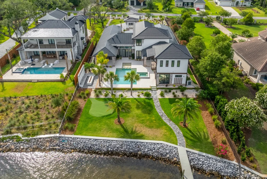
J Beard Graphics aerial photograph showing a waterfront home, pool, lot and surrounding landscape at Driftwood Point
Aerial perspective · Driftwood Point

See the bigger picture

The setting is part of the story.

Road frontage, access, water, tree cover and surrounding development can be hard to understand from the ground alone. Aerial perspectives help put those features in context.

Parcel lines or markers can help orient buyers when appropriate. They are visual marketing references and do not replace a survey.

Plan Your Aerial Coverage

Optional Upgrades

Add what the property needs.

These are the supporting services available in your Land + Aerial booking form. Select them where they add useful coverage.

01

Aerial Video Showcase

Add a professionally edited aerial video showcasing the property, surrounding area, and notable features from the air. Includes cinematic drone footage, licensed background music, and tasteful text overlays. Approx. 1–2 minutes.

02

Expanded Ground Coverage

Additional ground-level photography for properties requiring multiple access points, extended road frontage, trails, significant land features, or more extensive ground coverage.

03

Community Amenity Images

Professional ground-level photography of shared community and resort-style amenities such as pools, clubhouses, fitness centers, beach access, common areas, and other features that help showcase the surrounding property experience.

04

Aerial Amenity Coverage

Professional aerial coverage of requested community amenities or shared features beyond the subject property. Intended for locations such as pools, clubhouses, beach access, marinas, or other community features.

05

Same-Day Photo Rush

Expedited same-day delivery of the professional photography portion of your order. Photos are prioritized for editing and delivered the same day for qualifying appointments. Other services, including video, 360° tours, floor plans, virtual staging, and third-party deliverables, follow their standard turnaround times.

How to Book

Parcel. Media. Appointment.

01

Share the parcel.

Enter the property address, approximate acreage and Parcel ID / APN when available. Include access information and any requested viewpoints or land features.

02

Choose your media.

Select Aerial Photography – Land for aerial-only photos, Land Media Package for aerial + ground-level photography, or Aerial Video Showcase for cinematic aerial video. Add supporting services and review current pricing.

03

Schedule the shoot.

Select an available appointment time, provide your contact information, then review and confirm your order.

Before You Book

A little clarity.

Can I book aerial photography without ground-level coverage?

Yes. Choose Aerial Photography – Land for aerial-only photography of vacant land, acreage, development sites or larger parcels. Choose Land Media Package when you want both aerial and ground-level photography. Pricing is based on acreage and shown in the booking form.

Does Land Media Package include ground-level photos?

Yes. It includes aerial perspectives, basic road-frontage and access-point coverage, and important visible land features. Expanded Ground Coverage is available for multiple access points, extended road frontage, trails or more extensive ground coverage.

What if the parcel has no street address?

Select Enter Manually in the booking form and use the nearest available location. Enter the Parcel ID / APN when available, plus the approximate acreage and any access or boundary notes.

Can I book aerial video by itself?

Yes. Aerial Video Showcase is available as a standalone service starting at $350. When added to Land Media Package, the video add-on starts at $270.

How is land photography priced?

Aerial Photography – Land and Land Media Package coverage and pricing are based on acreage. Enter the approximate total acreage of the parcel or area to be photographed, using the property appraiser or listing information when available. Review the applicable coverage and current price in the form.

What goes into the price of professional aerial media?

The flight is only part of the picture. Professional aerial media brings together FAA certification, flight planning, airspace and weather checks, professional equipment, skilled camera work and careful editing. We choose perspectives that help buyers understand the property, its access and its surroundings. Your investment covers the preparation, judgment and finished marketing media that give those views a purpose.

Can you show parcel lines?

Parcel lines or markers are included when appropriate. Share the Parcel ID / APN and any boundary notes when booking. Marketing overlays help show the parcel in context; they do not replace a survey or establish legal boundaries.

What if weather or airspace affects the shoot?

Aerial services are subject to weather, airspace and safe operating conditions. We’ll coordinate with you if conditions affect the planned coverage or appointment.

When will I receive my media?

Delivery timing is measured from the completed shoot.

  • Photography: Standard 24-hour delivery.
  • Aerial Video Showcase: 2–3 days total after the shoot.

Photos may arrive before the remaining media in your order. Same-Day Photo Rush applies to photography only and is available for qualifying appointments.

Service Area

From coastal lots to open acreage.

Land and aerial media across Northwest Florida, with Crestview as home base.

CrestviewNicevilleFort Walton BeachDestinSanta Rosa BeachPensacolaMiltonValparaiso

Ready to show the whole property?

Put the land in perspective.

Tell us about the property or parcel, choose your aerial media, and select an available appointment time.

Book Land + Aerial